Résultats de la recherche : "Saint-Laurent-Rochefort" 53 résultats
Notice d'illustration
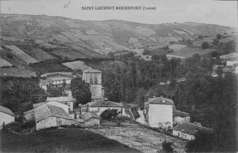
IVR82_20034200323XB
Présentation de la commune de Saint-Laurent-Rochefort
SAINT-LAURENT-ROCHEFORT (Loire)
Notice d'illustration
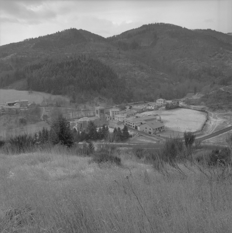
IVR82_20014201252X
|
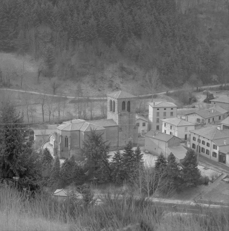
Présentation de la commune de Saint-Laurent-Rochefort
Vue du village de Saint-Laurent-Rochefort depuis la madonne qui le surplombe. Janvier 2001.
Notice d'illustration
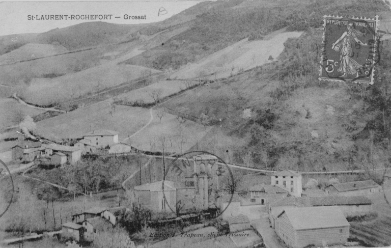
IVR82_20024200219XB
Présentation de la commune de Saint-Laurent-Rochefort
St-LAURENT-ROCHEFORT - Grossat. Edition J. Trapeau, cliché Tessaire.
Notice d'illustration
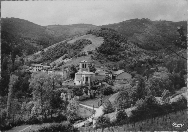
IVR82_20034200319XB
Présentation de la commune de Saint-Laurent-Rochefort
St-Laurent (Loire) 1 - l'Eglise / Combier IMP.MACON (S.-et-L.) / Cim.
Notice d'illustration
IVR82_20004200319P
|
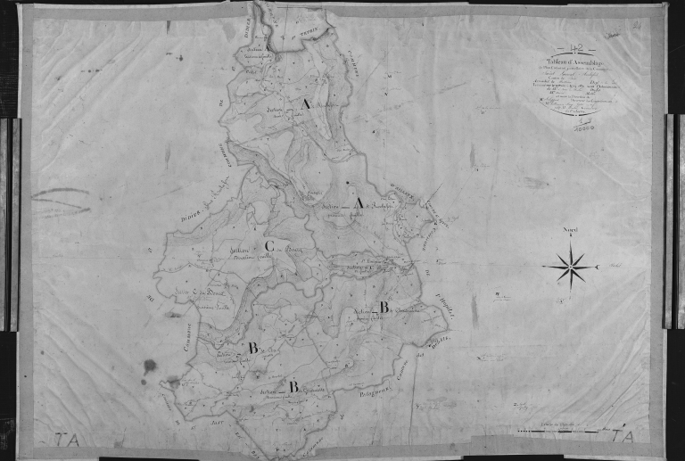
Présentation de la commune de Saint-Laurent-Rochefort
Plan cadastral ancien, 1827. Tableau d'assemblage, échelle originale 1/10 000e.
Notice d'illustration
IVR82_20004200322P
|
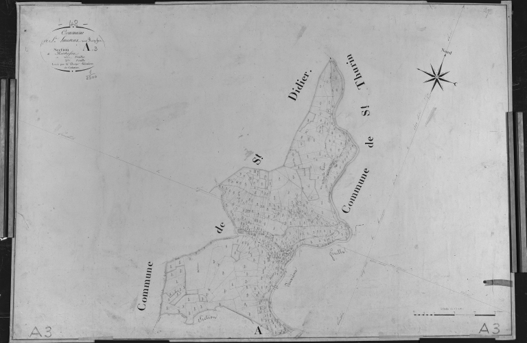
Présentation de la commune de Saint-Laurent-Rochefort
Plan cadastral ancien, 1827. Section A3 de Rochefort, échelle originale 1/2500e.
Notice d'illustration
IVR82_20004200321P
|
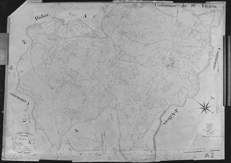
Présentation de la commune de Saint-Laurent-Rochefort
Plan cadastral ancien, 1827. Section A2 de Rochefort, échelle originale 1/2500e.
Notice d'illustration
IVR82_20004200325P
|
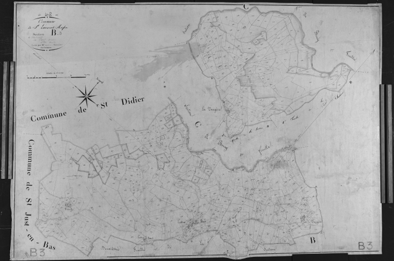
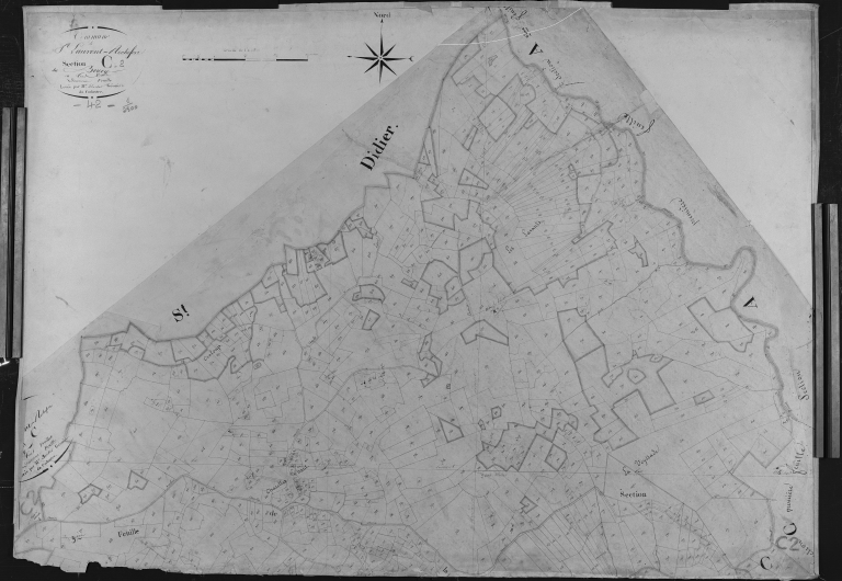
Présentation de la commune de Saint-Laurent-Rochefort
Plan cadastral ancien, 1827. Section B3 de Chadenatte, échelle originale 1/2500e.
Notice d'illustration
IVR82_20004200328P
|
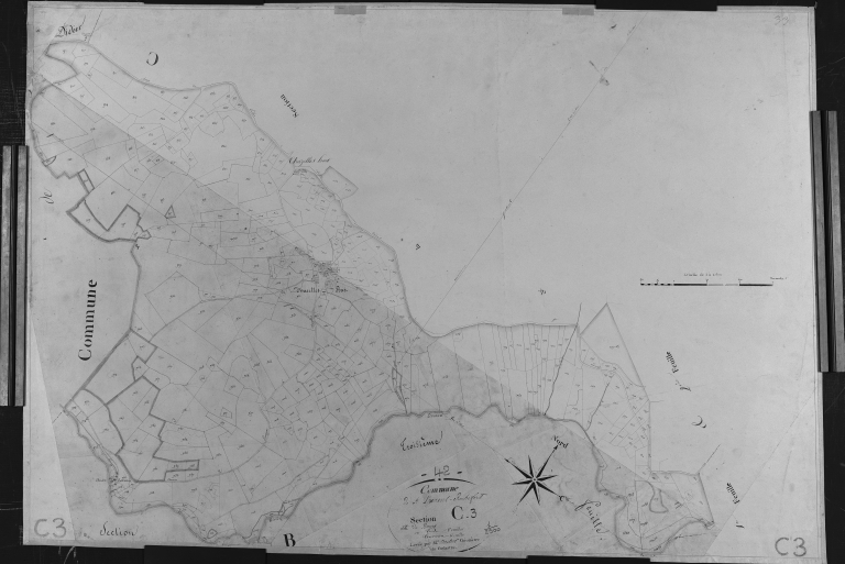
Présentation de la commune de Saint-Laurent-Rochefort
Plan cadastral ancien, 1827. Section C3 du Bourg, échelle originale 1/2500e.
Notice d'illustration
IVR82_20004200324P
|
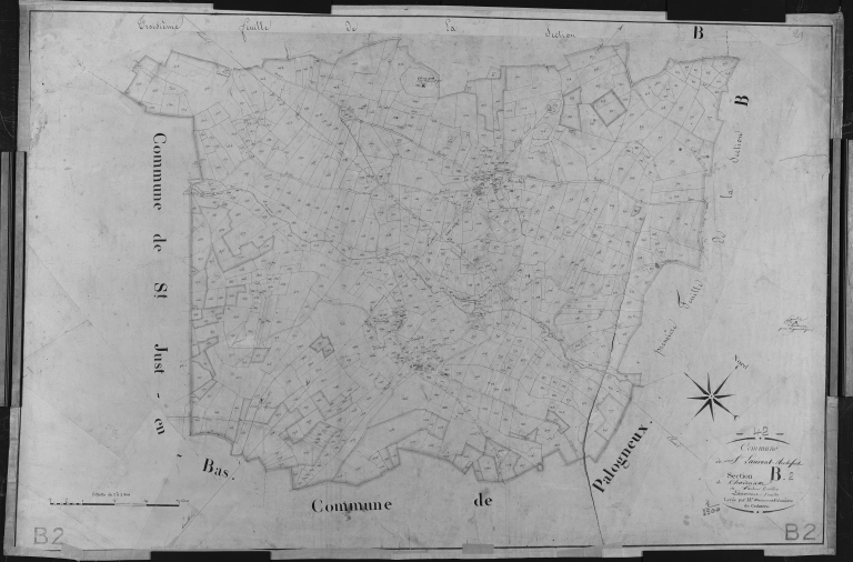
Présentation de la commune de Saint-Laurent-Rochefort
Plan cadastral ancien, 1827. Section B2 de Chadenatte, échelle originale 1/2500e.
Notice d'illustration
IVR82_20004200329P
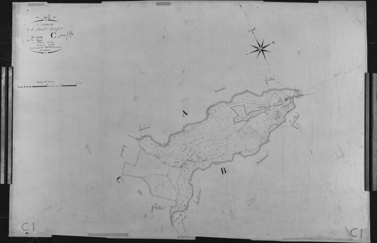
|
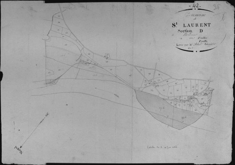
Présentation de la commune de Saint-Laurent-Rochefort
Plan cadastral ancien, 1827. Section D de Médime, échelle originale 1/2500e.
Notice d'illustration
IVR82_20004200320P
|
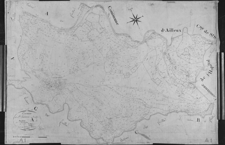
Présentation de la commune de Saint-Laurent-Rochefort
Plan cadastral ancien, 1827. Section A1 de Rochefort, échelle originale 1/2500e.
Notice d'illustration
IVR82_20004200323P
|
Présentation de la commune de Saint-Laurent-Rochefort
Plan cadastral ancien, 1827. Section B1 de Chadenatte, échelle originale 1/2500e.
Notice d'illustration
IVR82_20004200327P
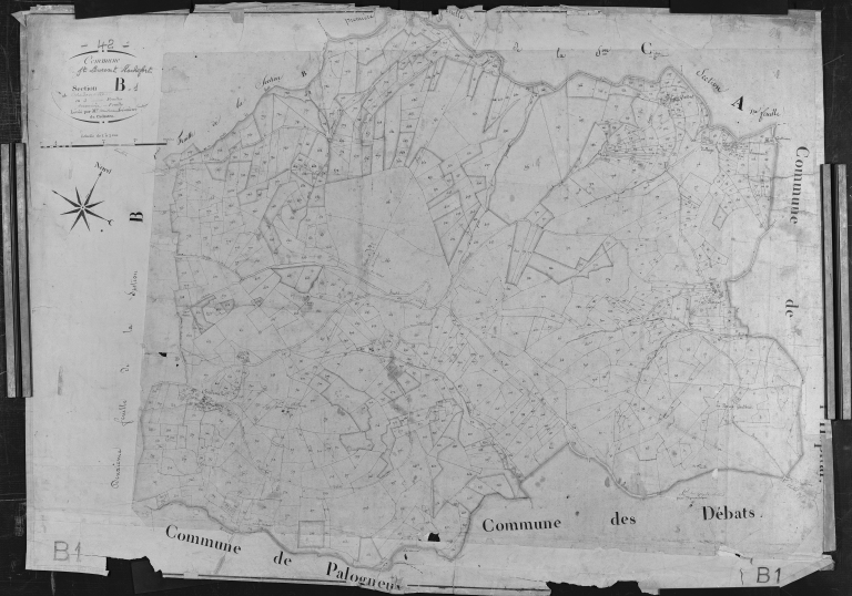
|
Présentation de la commune de Saint-Laurent-Rochefort
Plan cadastral ancien, 1827. Section C2 du Bourg, échelle originale 1/2500e.
Notice d'illustration
IVR82_20004200326P
|
Présentation de la commune de Saint-Laurent-Rochefort
Plan cadastral ancien, 1827. Section C1 du Bourg, échelle originale 1/2500e.
Notice d'illustration
IVR82_20024201405X
|
Présentation de la commune de Saint-Laurent-Rochefort
Vue du village centrée sur l'église, depuis la route de Rochefort, au nord.
Notice d'illustration

IVR82_20024201404X
|
Présentation de la commune de Saint-Laurent-Rochefort
Vue du village centrée sur l'église, depuis la route de Rochefort, au nord.
Notice d'illustration
IVR82_20004200349X
|
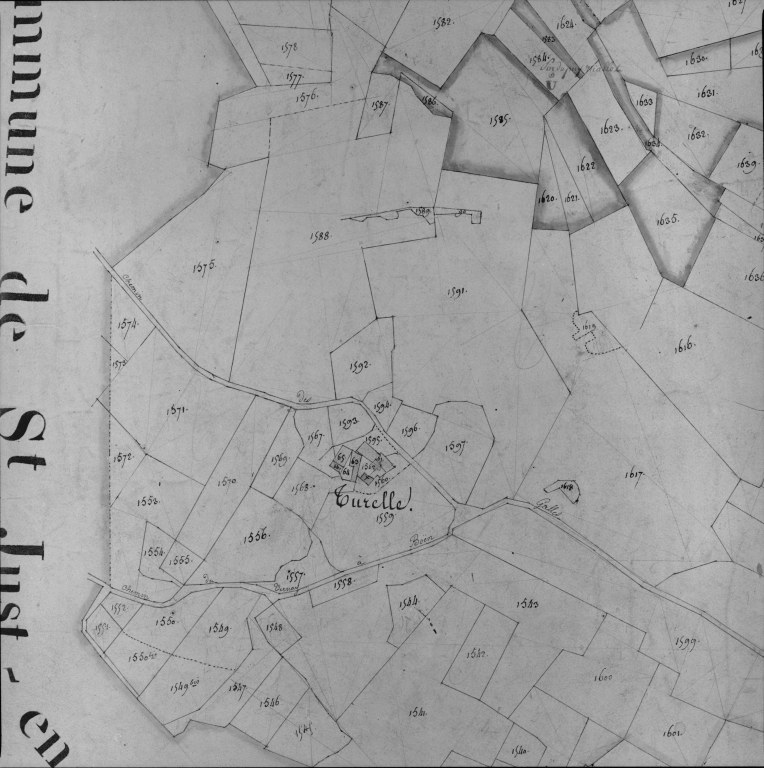
Présentation de la commune de Saint-Laurent-Rochefort
Plan cadastral ancien, 1827. Section B3, détail de Turelle, échelle originale 1/2500e.
Notice d'illustration
IVR82_20004200331X
|
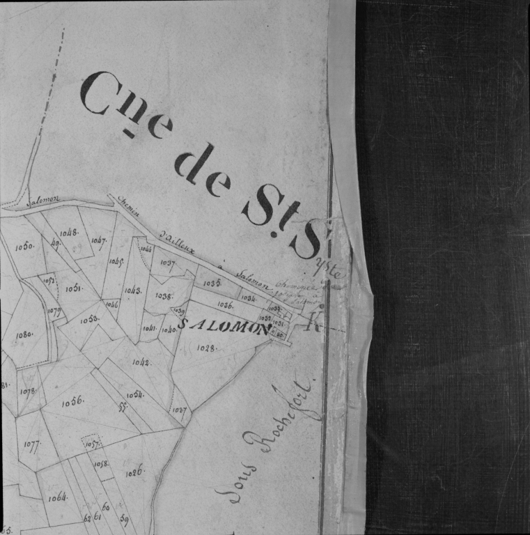
Présentation de la commune de Saint-Laurent-Rochefort
Plan cadastral ancien, 1827. Section A1, détail de Salomon, échelle originale 1/2500e.
Notice d'illustration
IVR82_20004200341X
|
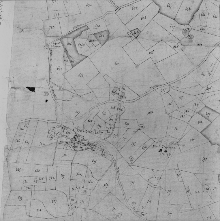
Présentation de la commune de Saint-Laurent-Rochefort
Plan cadastral ancien, 1827. Section B1, détail de Chadenatte, échelle originale 1/2500e.